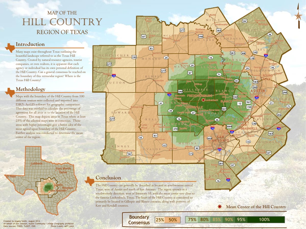
The Texas Hill CountryExisting maps with the boundary of the Hill Country from 100 different sources were collected and imported into ArcGIS for geographic comparison. This data was overlaid to calculate the percentage of agreement for all areas as to the location of the Hill Country. This map depicts areas in Texas where at least 25% of the selected maps were in consensus. Further analysis was conducted to determine the mean center of the region.
Created for and on behalf of Don Jonsson, Geography professor at ACC, August 7, 2014 |
|
